OPERATING HOURS
MON-THURS || 7:30 - 16:30
FRI || 7:30 - 13:30
WEEKENDS & PUBLIC HOLIDAYS || CLOSED
Place of Coal
The Emalahleni Municipal area, which means the “place of coal”, consists inter alia of the towns of eMalahleni, Kwa-Guqa, Ga-Nala and Ogies. The town of eMalahleni was established in 1903. It was named after a ridge of white rock located near the present railway station. In the early years, this ridge was a halting place for transport wagons and a trading post. eMalahleni has a large collection of heritage assets, which is currently under threat from rapid development. Emalahleni is probably the most industrialised municipal area in Nkangala and its landscape features mainly underground and opencast coalmines. This area has the largest concentration of power stations in the country. Its mining and industrial history is reflected in the area’s heritage places. This includes elements of industrial history, military history, architectural/engineering and graves which should be protected and conserved.
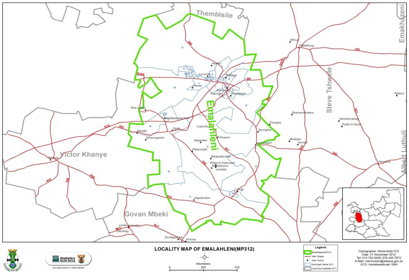
Emalahleni Local Municipality is located within the Mpumalanga Province and is situated in the jurisdictional area of the Nkangala District Municipality. The district is located to the North-West of the province and is the smallest district in land mass (21%) and has the second largest population concentration (35%) in the province. It covers an area of about 2677.67 km2 in extent. The Nkangala District Municipality is made up of six local municipalities, namely:- Emalahleni Local Municipality,
- Emakhazeni Local Municipality,
- Steve Tshwete Local Municipality,
- Thembisile Hani Local Municipality,
- Dr JS Moroka Local Municipality, and
- Victor Khanye Local Municipality.






Emalahleni
Steve Tshwete
Emakhazeni
Thembisile Hani
Dr. JS Moroka
Victor Khanye
Location
Emalahleni Local Municipality is strategically located within the Mpumalanga provincial context and it serves the function of a gateway municipality and town into the province for eight of the nine provinces of South Africa. Its proximity to the Johannesburg, Ekurhuleni and the Tshwane Metropolitan Municipalities, which jointly constituted the largest economy in the country serve the municipality favourably.
The road infrastructure connecting Emalahleni to the rest of the country is also very well maintained and serviced by logistics freight activities to such that the significance of the municipality in the Industrial Development and Transportation strategies of the country are recognised. Connecting the municipality to the rest of the country as mentioned above is the significant road infrastructure consisting of the N4 and N12 freeways. The N4 and the N12 converge at eMalahleni town, N12 starts at eMalahleni and then the N4 proceeds to Nelspruit and Maputo.
Maputo Corridor
Running parallel to the N4 is a rail line that connects Gauteng through eMalahleni to Maputo. This significant rail and road infrastructure has been identified as part a Southern African initiative to connect Walvis Bay (on the west coast of Africa) and Maputo (on the east coast of Africa) called the Maputo Corridor.
These significant transportation and freight linkages are critical to ensure improved trade between Namibia, Botswana, South Africa and Mozambique. The roads to the south of the municipality and rail connections connect eMalahleni to Richards bay and Maputo Harbour; this provides significant logistic opportunities for the coal that need to be exported through the harbours.
Energy Mecca of South Africa
The southern areas of the Emalahleni Municipality form part of the region referred to as the Energy Mecca of South Africa, due to its rich deposits of coal reserves and power stations such as Kendal, Matla, Duvha and Ga-Nala, while the new Kusile power station is located a few kilometres to the east of Phola. The Southward road and rail network connect the eMalahleni area to the Richards Bay and Maputo harbours, offering export opportunities for the coal reserves.
The eMalahleni Municipality area of jurisdiction consists of the main following towns/ settlements, ranked according to population:
- eMalahleni complex
- Phola and Ogies
- Ga-Nala (Kriel) and Thubelihle
- Rietspruit
- Van Dyksdrift
- Wilge
Emalahleni Local Municipality (ELM) as with all other municipalities in the country continues to be with the deep spatial challenges of the past where communities continue to live separately from each other, although strides have been made to bring the poor communities closer to the centres of economic activities, land availability continues to hamstrung the programme.
